The Wetlands Restoration
Project
The Lake - Civil Engineer's Plan
|
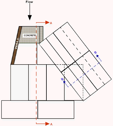
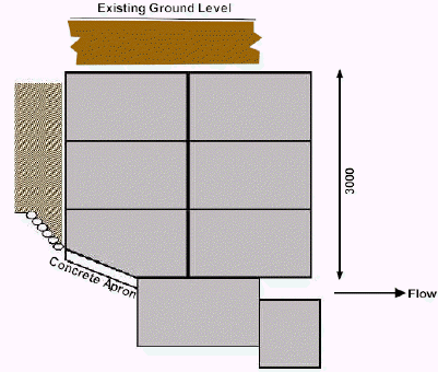
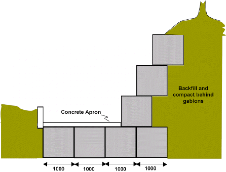
Below are the Civil Engineer's plans for the sluice at the eastern end of the Southern Lake (see map). The sluice was designed to control the depth of water in the Southern Lake. By closing the sluice the water level is forced up until it flows over the spillway and over the top of the sluice. Opening the sluice releases water and the level drops in the lake. Much of the structure of the sluice is made with gabion baskets, represented in the diagrams below by white or grey boxes.
|
PLAN
|
|
Section A-A
|
|
Section B-B Schematic diagrams - not drawn to scale |