The Leat Project
Leat Map
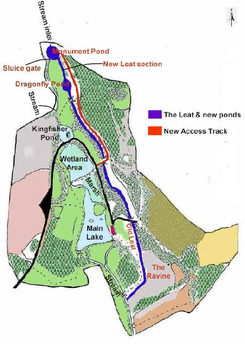
The map shows the newly restored leat east of the stream and sensitive wetland areas. The Leat diverts floodwater away from the main aquatic habitats at the Centre. This prevents serious siltation of these valuable habitats. |
The names of the
features which are printed in red below
are linked to images. Click on the words to see them.
|